| Previous: Part 3 : A Day Off in the Ordesa Canyon | Index | Next: Useful Information |
|
Now it was time to head back towards the frontier. We had decided to cross back into France at the Brèche de Roland, a landmark that we had seen in the distance from a couple of vantage-points during the preceding days. We would do this in two days, camping as high up as we could get on the Spanish side.
So on this morning we started by returning to the Ordesa Canyon. We decided to walk into the canyon rather than take the inconvenient bus, but with hindsight walking can't be recommended. The map shows paths from near the park entrace up to the visitor center in the old parador and from there through the forest parallel to the road; these paths are both closed and there is no alternative to walking along the tarmac.
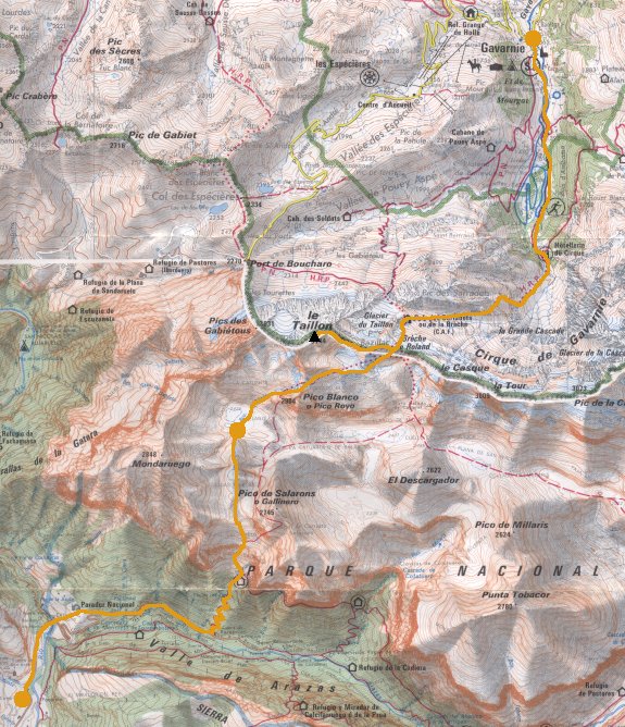
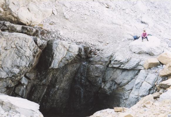
Anyway, we eventually started climbing up the North side of the canyon. The path was steep but not too hot thanks to the shade of the trees. It was much like our ascent on the other side the day before, except that this time we were carrying our full racksacks. Eventually we emerged out of the trees; the path continued to ascend, but there seemed to be sheer cliffs above us and it was hard to believe that there was a route through. The path was narrow with occasional cables to hold on to and some scrambling, and always a huge drop beneath.
 |
Cliffs at the top of the climb, and el Tozal Del Mallo |
|---|
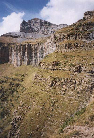
Eventually we made it to the top and the very different landscape of the plateau was revealed. So many people see the Ordesa Canyon, but so few see this. We followed a dry valley; in places the terrain was bare limestone and elsewhere there were patches of grass. We saw a few small streams but they disappeared quickly into caves.
 |
The dry valley, with Cabierto Norte on the skyline |
|---|
Finally we reached the end of the dry valley at what looked like a dried-up lake bed, and we found a corner for our tent for the night. It wasn't our longest walk by a long way, but it certainly had the most ascent.
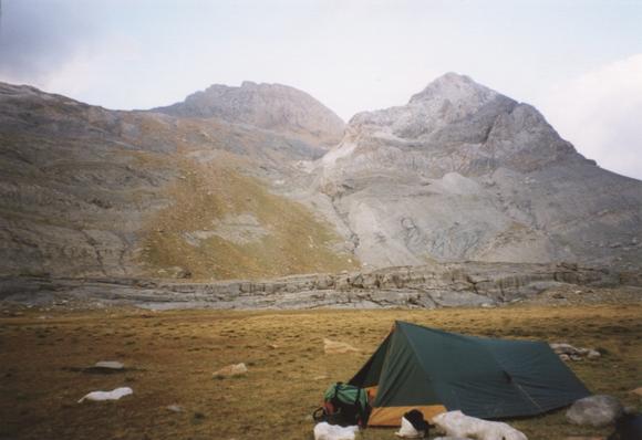 |
Camping at the Plana Caturate with Punta Blanca and part of Le Taillon in the background |
|---|
Total for the day:9km, 1350m.
The next morning we packed up and headed up hill, aiming for a gap at 2836m between Punta Blanca and the frontier ridge.
 |
A huge cave on the way to Punta Blanca |
|---|
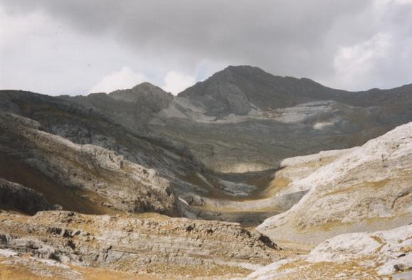
From the gap it looked as if the rocky slopes ahead finished at the foot of an inpenetrable cliff, but we knew that somewhere in there was the Brèche de Roland, and as we got closer it slowly revealed itself.
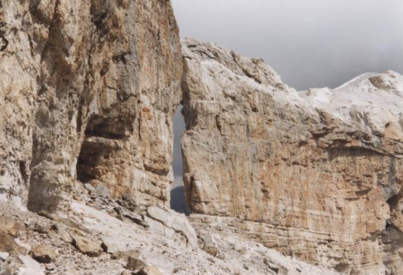 |
The Brèche de Roland as it reveals itself |
|---|
We eventually reached the frontier, to be met by dozens of other visitors - the first people we'd seen since we climbed out of the Ordesa Canyon. From here we took a 2km diversion to bag the summit of Le Taillon, our first and only 3000m peak at 3144m.
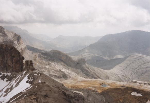 |
View South-Eastwards from near Le Taillon |
|---|
There was no view westwards from Le Taillon - in fact as storm was coming in from that direction, so we wasted no time starting our descent. We returned to the Brèche de Roland and descended to the refuge, crossing a minute glacier on the way. From here we decided to take the steep "Echelle des Saradets" path down to the Cirque de Gavarnie. The view of the Cirque is indeed impressive, with one large waterfall and several smaller ones tumbling into it.
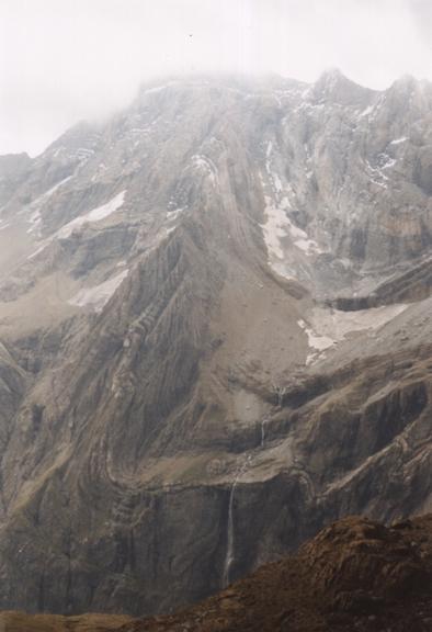 |
La Grande Cascade |
|---|
At about this point the storm caught up with us and followed us down to the village of Gavarnie, where we ended our trip dripping in a restraunt.
Total for the day:13.5km, 730m.
| Previous: Part 3 : A Day Off in the Ordesa Canyon | Index | Next: Useful Information |