11 July 2003: Stockholm, Sweden
Subject: Korea
I'm now in Sweden and have Mike and Cia's PC to abuse for a while, so finally I have the chance to write up what I've been doing for the last few weeks in more detail than my last effort. First, the last bit of Korea.
Busan
After my wet morning at the foot of Jirisan I went by bus to Busan, Korea's second city. It's a big port in the south east corner of the country, facing Japan, and if you're looking for it on a map it may be called Pusan. A couple of years ago the South Korean government decided to change their romanisation scheme; the new one is simpler, but less phonetic, and in particular the first letters of lots of place names have changed, which can make things difficult for a traveller.
I checked into quite a nice hotel with a real bed and more importantly enough space in the bathroom to hang up all my wet stuff. And a free newspaper provided exactly what I needed to dry out my boots. After some of the places that I've visited previously it was nice to see that this Korean hotel had fire extinguishers and even a torch and smoke hoods in the wardrobe. As a final touch there was an emergency escape rope thing above the window (which I suspect may save fewer lives than are lost to idiots playing with it!) Or was all of this just because I was in room 911?
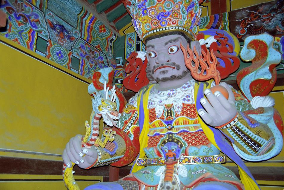
As it was still raining I decided against visiting Busan's famous beach, but did go to their famous Budhist temple, Beomeosa. It has essentially the same architectural style as the historic (and reconstructed) buildings in Seoul, with a few more Budhist touches thrown in. Here is one of the "temple guardians" in the gate house:
Gyeoungju and Gungju
The weather was getting a bit better but not exactly sunny, so I decided to visit the historical city of Gyeoungju rather than any more national parks. Gyeongju was the capital of the Silla kingdom which was around for approximately the whole of the first millenium of the Christian callendar.
The most distinctive features of the town are the ancient tombs that are right in the middle of the urban area. They are big tumulii quite reminiscent of ancient British sites, but more reminiscent of Tellytubbieland:
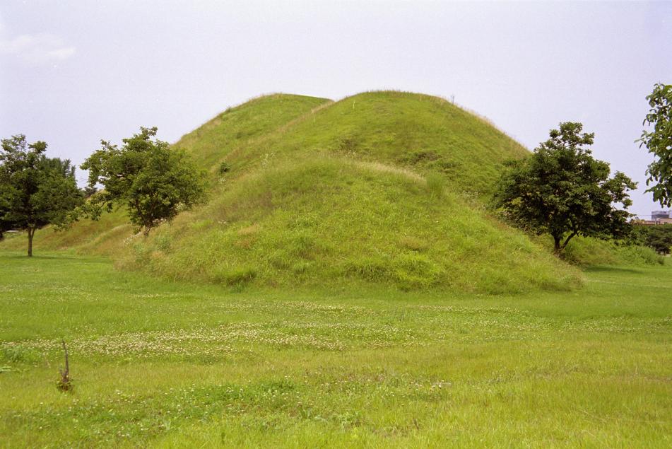
Some (most?) of them have been excavated and one is now hollowed-out so you can see how the things that they found were organised inside. But you have to visit the museum to see the best of the artifacts, which include some great gold crowns and other ornaments, bronze and iron tools and weapons, ceramics and so on. The museum also has a spectacular huge bronze bell dating back to 700 or so. The museum's web site is at http://gyeongju.museum.go.kr/.
I then climbed Namsam, a big hill to the south of the town that is supposedly full of buddhas carved into the rocks and the like. Unfortunately you can't expect to find much if you just follow your nose as I did - you really need to follow a guided route or have GPS coordinates for the places of interest! But it was a pleasant walk anyway.
Outside the town there is another Budhist temple, Bulguksa, which is supposed to be one of the best in the country. It was built in the early 1970s as a scheme of the then president. The (entirely predictable) story is that a temple had existed there centuries before and been destroyed by the Japanese, leaving only a few stone foundations and some steps. It is quite pleasant though not worth quite as much fuss as they make about it. The bit that I liked most about both this temple and Beomeosa was the entrance structure with the four temple guardians, huge carved wooden figures carying various symbolic items. I've found a good web site with lots of stuff about asian architecture: http://www.orientalarchitecture.com/.
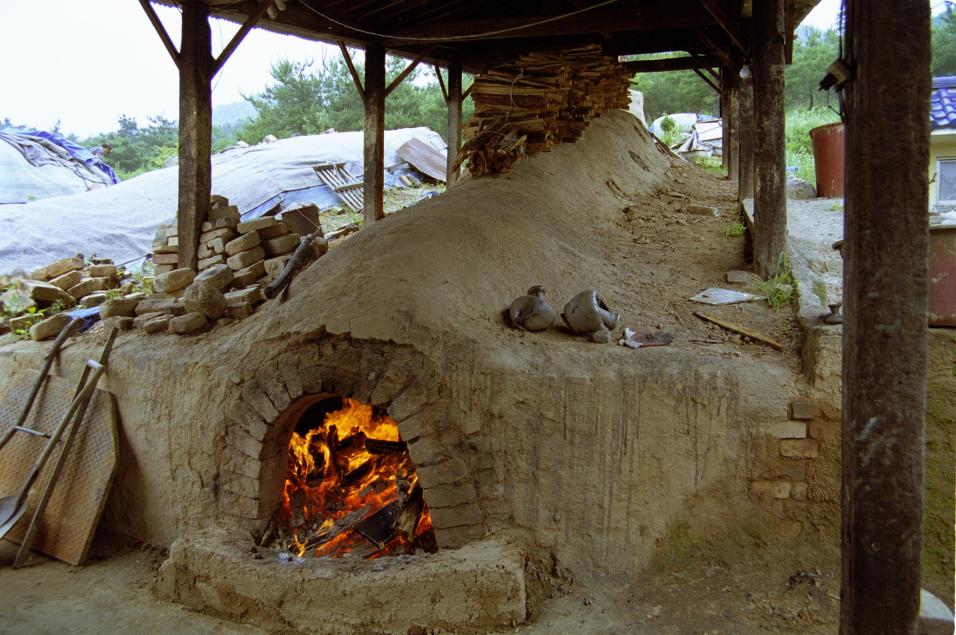
My final stop in Gyeongju was a handicrafts village, where unfortunately the museum of Silla-era technology was closed due to a power cut. But the shops were all still open selling mostly ceramics and a few bits of embroidery and jewelery. Most interesting was a pottery where they were using a reconstructed Silla-era kiln to fire the pots; it is a sloping tube running up the hillside at about 45 degrees with a wood fire at the bottom, chimney at the top and pottery being fired in the middle.
Then, to break my journey back to Seoul, I stopped off in another historical town, Gongju. This was also a capital, this time of the Baekje kingdom, which I think co-existed with the Sillas over in Gyeongju. They also have a museum with some really excellent artifacts from an excavated royal tomb.
Panmunjom
Then it was back to Seoul for one last excursion before leaving the country - a visit to Panmunjom, the famous point on the border between North and South were the two sides face each other over a table with the border running down the middle. It's an extraordinary place.
First stop, well before the border, was at a large building on the top of a hill from where you might see a view into the North if the visibility is good enough (it wasn't when I was there). It also has some small exhibitions of North Korean factory products and school textbooks. The textbooks would be quite interesting if you could read Korean. The English book was printed on ghastly paper and the excerpts were about Kim Il Song, but the language was fine. And one of the maths books seemed to be about writing programs to solve equations in BASIC, which I suspect is not too much different from the rest of the world. This place is called the "Unification Observatory" - a ridiculous name, as in fact what you get to observe is the extreme disunity.
The ceasefire line from the end of the war in 1953 is flanked by 2km of demilitarised ground on each side with no way across, except at Panmunjom. This has turned it into something of an oasis for wildlife, but that doesn't seem to excite anyone very much. A road takes buses of foreign tourists to Camp Bonifas, the "United Nations" (actually U.S. and Korean) base, and from there through the fences and minefields and then the demilitarised zone ("DMZ") to Panmunjom. You get to see the "bridge of no return" where prisonners of war were exchanged at the end of the war and the single-storey buildings - sheds really - that actually span the border where intergovernmental talks are sometimes held. It doesn't take long and in my mind it raised as many questions as it answers.
If you visited the North side of the border - which you can - you would expect a propoganda trip. I wasn't sure what to expect from the South. It turned out to be reasonably factual, but you have to stay alert to the spin that the guides put on what they're telling you. They are South Koreans (or Americans) and give their side of the story. Here are some of the unanswered questions that I had:
* These trips are only really for foreigners. If a Korean wants to go they have to be vetted by the security services first, and a whole family can't go in one group. "Why?", I asked. "To make sure that they don't try to cross to the North", was the reply. So South Koreans aren't free to leave their country if their government doesn't want them to.
* Although today it's clear that anyone in their right mind would prefer to live under the regime in the South than in the North, people forget that for the majority of the 50 years since the war both sides have lived under dictatorships.
* The United States cites this border as the reason why it still needs mines and won't ratify the Anti-Personnel Mine Convention banning them. This allows generalissimos around the world to say "why should I stop using mines? - look, even the world's most powerful country still needs them". Having just visited Cambodia where there are plenty of people who can testify to the effect that mines have on the post-war civilian population, I would like to know what efforts the South Koreans and their American friends have put into finding an alternative to mines to defend their border.
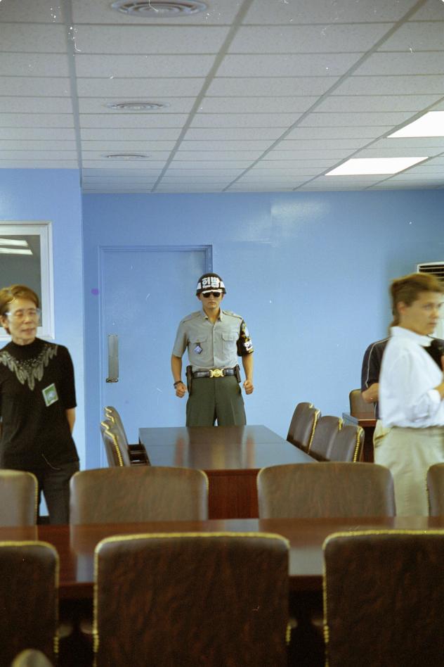
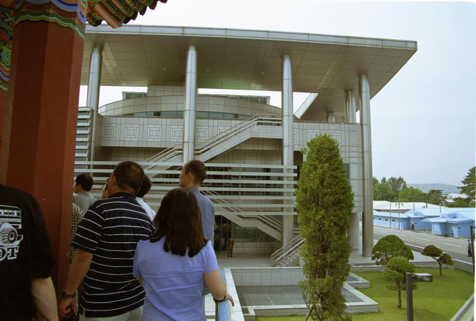
* Does either side want an end to the conflict at all? Are they actually trying to be friendly or are they antagonising each other? The impression that I get is the latter. There are plenty of examples. In the vicinity of the conference room there are South Korean guards who stand in a bizzare frozen posture with clenched firsts by their sides, eyes hidden behind dark sunglasses. It is apparently something to do with taekwondo. I asked why they stand with this pose. The answer, according to the guide, is "to intimidate the North Koreans". My next question, "Why do they want to intimidate the North Koreans?", she could not answer. Korea has a Budhist background. Wouldn't it be better to have some monks singing a nice contemplative peace-and-love chant over the border? Then there's the mine's-bigger-than-yours architecture over the border. The North had the world's biggest flagpole. So the South built one a hundred metres tall. So the North have built one a hundred a sixty metres tall. Then there are the buildings behind the cross-border sheds on either side. The boss of Hyundai has in the last few years paid for a huge new concrete-and-glass-and-chrome thing to be built on the South side. The North have a place that probably looked quite respectable until it was faced with this new edifice, but now they've built an extra storey on the top. It seems to me that whatever the people of South Korea as a whole think, the politicians and military characters who run this place see their role as maintaining the antagonism, not building trust, friendship and peace.
Here are some photos. First, the inside of one of the meeting rooms. The border line goes down the middle of the table in the foreground. The action man at the other end is a South Korean martial-arts soldier to "protect" us from the North Koreans. Note the "intimidating" pose and dark glasses:
The is the North Koreans' frontier building. Originally it had only two floors and the South had something similar.
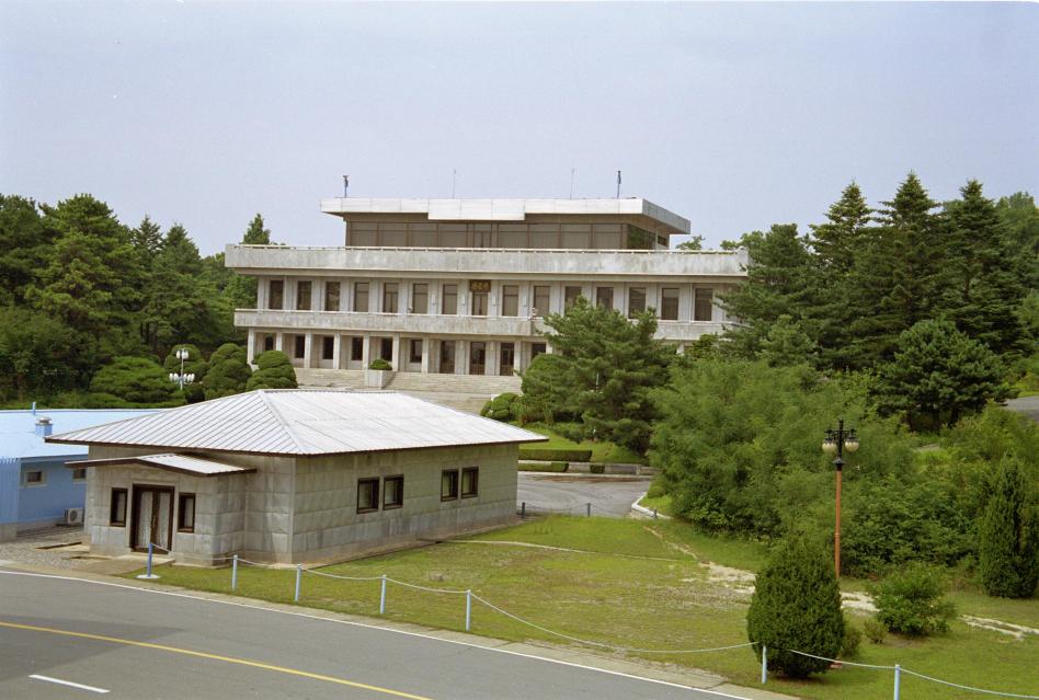
Then the South Koreans built this huge edifice (actually built by the founder of Hyundai). The North Koreans replied by adding the smaller top floor to their building.
News about Finland and Sweden to follow.