17 April 2003: Launceston, Tasmania, Australia
Subject: Australia
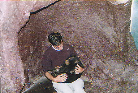
Hug A Wombat!
When I first arrived in Melbourne I went on a day trip to see the Fairy Penguins at Phillip Island. On the way there we stopped at the "Big Worm", a wildlife park that looks after orphaned animals, mostly when their mothers have been killed on the roads. One of the features is the "hug a wombat" corner, where you can have your photo taken with a cute baby like this one:
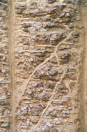
Apparently Bill Bryson has something to say about Australians and their love of weird rock formations. Well he's not wrong. We also stopped off to see a cliff that looks like a cemmented stone wall:
Tasmania
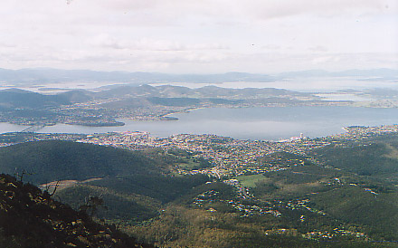
I thought I'd better come to Tasmania first as the Summer is coming to an end down here. The warmer northern bits of Oz can wait for a while. So I flew from Melbourne to Hobart, and spent a few days there being indecisive about whether the weather was good enough to go exploring in Tasmania's wilderness interior. I did manage one excursion from Hobart, to the top of Mount Wellington, which is about 1200m high and just behind the town. Here is Hobart as seen from the top:
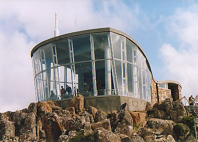
Charles Darwin climbed Mount Wellington during his trip on the Beagle (I have unintentionally been following quite a few of his footsteps), and called his guide "a very stupid man" for taking him up by a bad route. Later the excursion became a popular day out for the people of Hobart, but in the depression of the 1930s someone had the ghastly idea of building a road to the top as a job creation exercise. In a foretaste of Tasmanian conservation arguments of later decades, everyone objected to the road but it was built anyway. The top, which like a lot of Tasmania's mountains is a cap of hard basalt-like dolerite formed into columns, now has a carpark and this horrible edifice (built as recently as 1988) to great those who have come up the hard way.
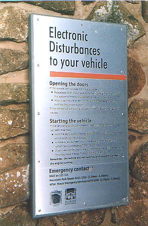
The top also has a big TV transmitter mast, and I though that ex-AT&T people would appreciate this notice (we had similar problems in our car park). In case you can't read it, it seems to say "if all else fails, use the key"!
Eventually I got myself organised and took a bus up to Lake St Clair, at the southern end of the Cradle Mountain - Lake St Clair National Park. This is one of the northen bits of the UNESCO-listed Tasmanian Wilderness World Heritage Area. The UNESCO listing is significant for historical reasons. Back in the early 1970s there were only two relatively-small national parks in Tasmania, protecting just the two very best scenic areas. One of these was Lake Pedder, but despite the apparent protection of being a national park, it was flooded as part of a hydro electric scheme. (You can read about this sad story, including how Tasmania has more power than it needs and proposals to drain the lake and restore the original scenery, at http://www.lakepedder.org/.) Since then much more of the island's wilderness has been given national park status, but conservationists cite the example of Lake Pedder as evidence that being a national park is no protection at all against the hydro-industrialisation and forestry lobbies. A proposal to flood the Franklin and Gordon river valleys drew international attention. But it seems that the Australian national government is more supportive of conservation than the state goverment, and a federal law was passed that offers protection to UNESCO-listed assets that the state government can't overturn.
Update: the BBC has a story about how the Tasmanian forestry people have managed to "accidentally" burn down the world's largest non-coniferous tree. It's being touted as an example of their environmental unfriendlyness. The story is at http://news.bbc.co.uk/1/hi/world/asia-pacific/2953448.stm.
Much of the wilderness area is inpenetrable, but a much-frequented hikers' track, the Overland Track, crosses the Cradle Mountain - Lake St Clair region.
The Overland Track
The Overland Track is normally a five to six day walk, but I decided to add another few days and get off this "tourist trail" for a few nights. I decided to branch off to the East and see the Walls of Jerusalem National Park as well. That was the plan.
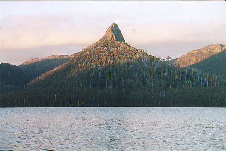
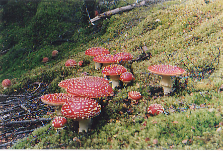
For the first three days the weather was quite pleasant - the picture above is Mount Ida, seen from near first night's stop at Echo Point on the shore of Lake St Clair. Then I left the main path and crossed the "Never Never" - a mostly-wooded valley where I saw these lovely fairy tale toadstalls.
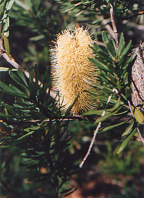
The trees here are a mixture of Northofagus - the Southern Beech, which is also found throughout New Zealand and Patagonia, and so dates from before the breakup of Gondowanaland - and species that have evolved more recently such as Eucalyptus. Another Australian oddity is this Banksia or Bottlebrush Tree.
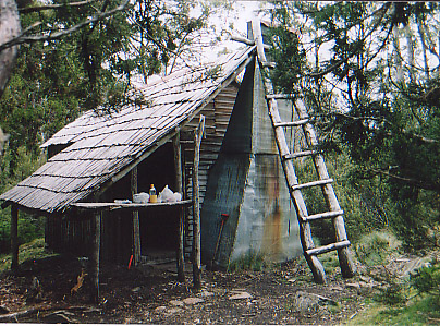
It was as I left the "Never Never" and arrived in the Walls of Jerusalem that it got a bit damp. In fact it poured for about 20 hours. But I was dry because I stayed inside this wonderful little hut at Junction Lake, which I had all to myself, playing patience and drinking tea.
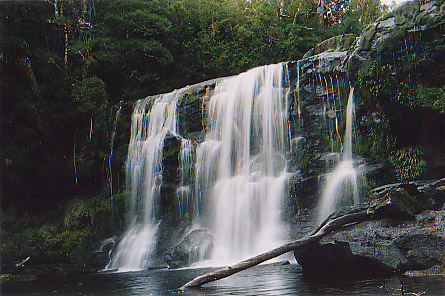
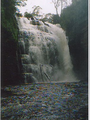
The next night was dry, but in the morning it started raining again and I decided to give up on the side trip and return to the Overland Track. So I trudged back throught the Never Never which had been transformed; the nice green flat bits that had looked like ideal camping spots were now knee-deep in water. Worst of all, each time I stopped I found leeches climbing up my boots and trousers. Yuk. But to make up for all the unpleasantness the waterfalls were looking really spectacular! Here are before and after pictures of McCoy Falls, in the Never Never:
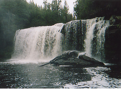
And here are two pictures of Hartnett Falls, the biggest falls on the Overland Track (I think). Before the rains the water was confined just to the gulley on the right, but afterwards it was spilling over the entire width.
When I got to the next hut, just as it was getting dark, the sight of the little coal-burning stove with other peoples' wet socks and gloves drying all around it was a very welcome one. Over the next couple of days I pressed on further North, with quite a lot of rain and - for variety - a bit of snow over the higher bits. The only real problem was that my boots were soaking, but at least I always had dry socks to wear inside them each morning.
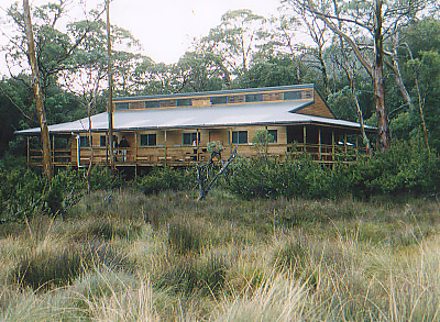
Most of the huts on the Overland Track are quite modern, and this one at Pelion Plains was gleamingly new. And once you've paid your A$13.30 National Park fee they are free! Unfortunately these new ones are a bit characterless, but you can't have everything.
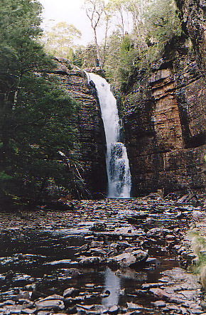
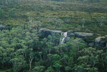
The last hut that I stayed in was the Waterfall Valley hut, and not surprisingly the waterfalls were being quite impressive there too. This one isn't normally big enough to warrant a name! Apparently the cliff that this and the other falls drop over also has a huge overhanging area that was used by aborigines as a shelter.
The morning that I left the Waterfall Valley hut the sun came out. But it had snowed quite a bit the previous afternoon and overnight, and when I first saw Cradle Mountain it was looking quite frosty.
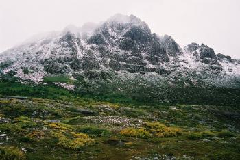
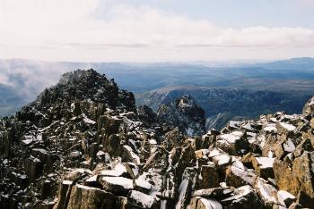
Cradle Mountain can be done as a day hike and as I got closer to it the paths started to fill up with day hikers as well as backpackers. I climbed to the top, which was quite a scramble - the summit is ringed by Giant's Causeway style basalt columns.
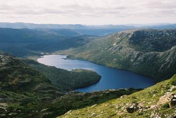
Here is Dove Lake, the main attraction for the day hikers who don't want to get up into the high country.
So finally I descended to the end of the road, just beyond the lake, and took a bus back to civilisation, in Launceston. (Which they seem to pronounce LaunCesTon, not Laun'ston like I think the Cornish do. There are plenty of British place names here. On the bus yesterday I passed through Sheffield, which appropriately enough is on the River Don. But it is a bit more agricultural than its English namesake. One place had a blackboard sign outside it advertising "Manure Laying Hens For Sale". Sounds like the opposite of the Golden Goose!)
Tomorrow I'm taking the overnight ferry over the Bass Strait back to Melbourne.