1 April 2003: Melbourne, Australia
Subject: New Zealand
Mountain Biking in Queenstown
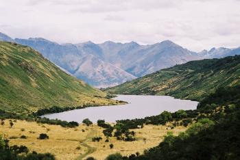
So I took the bus from Franz Joseph glacier all the way down to Queenstown, which is known as New Zealand's "adventure sports mecca". People from all around the world come here to bungy jump from bridges, throw themselves out of planes and other equally high-adrenelin activities. I was only there for a day and did something relatively sedate: I hired a mountain bike and spent a few hours cycling up to a pretty lake and back. Here's a picture of my destination. The landscape this side of the mountains is indeed much drier than the other and the hillsides are quite bare, making it look more like the English Lake District than anywhere that I've been for a while.
Wanaka and Mount Aspiring National Park
From Queenstown I went back North to Wanaka and then set off into the Mount Aspiring National Park for a few days camping. My plan was to climb Sisyphus Peak, a snow-free mountain from which there should be good views to the higher and glaciated Mount Aspiring itself and its neighbours. (I have just done some internet research to find out who Sisyphus was. According to http://www.pantheon.org/articles/s/sisyphus.html in Greek mythology he was "sly and evil and used to way-lay travelers and murder them"; as punishment in the underworld "he is forced to roll a block of stone against a steep hill, which tumbles back down when he reaches the top. Then the whole process starts again, lasting all eternity". So an appropriate name for some mountains, though to be honest I don't think this peak deserves such a harsh comparison!)
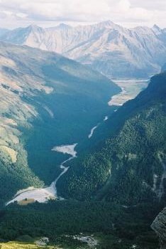
Sisyphus Peak is remote enough to need a three-day trip; one day to walk in, one to climb to the top and back, and a final day to walk out. The first and last days were easy enough, following the banks of the East Matukituki river up from the road. At first the valley is quite wide with cattle and sheep farming, but then it narrows and the path is forced up into the wooded hillside. Then the valley opens out again at Junction Flat, where the route turns left into a tributary valley, the Kitchener. This photo shows the East Matukituki valley, from the start of the walk in the distance up to Junction Flat in the foreground.
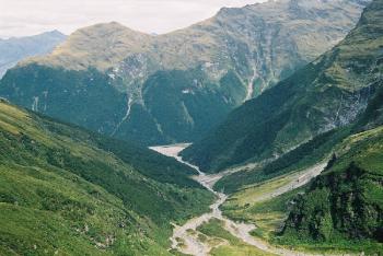
I walked up the Kitchener, still on a fair path, as far as Kitchener Flat where the Rainbow Stream joins and there is a good camping spot. (There is also a dry bivvy site under an overhanging rock, but as the weather was nice and dry I chose the green patch with the view!). This is a view of the upper Kitchener valley from near my campsite: like all the streams in the area it starts as glacial meltwater.
The next day's walk started by crossing the Kitchener River. It was not too difficult once I had found a shallow spot: only knee-deep and not flowing too quickly. Then I spent the next few hours slowly ascending the Rainbow Valley, which involved more stream crossings, this time over a smaller but swifter stream that was just too wide to jump. Each time I took my sandals off and put my boots back on the river meandered to the other side of the valley and another crossing was needed!
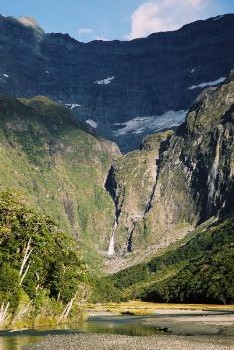
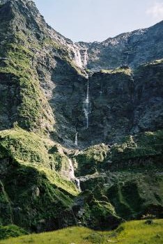
All the way up the valley there were views of tall thin waterfalls cascading down, presumably with glacial meltwater from the hanging valleys high above. As I got higher the snow-capped peaks slowly came into view.
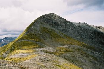
Eventually I got to about 900m (my campsite was at about 500m) and left the stream behind to climb up the hillside. The vegetation slowly thinned out and eventually I reached a barren rocky col at about 1700m. From the col it was a quick easy hike up to the top at about 1850m:
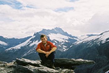
The view from the top was good: there were big snowy mountains and glaciers to the West and North, and deep valleys, including the ones that I had walked up to the East and South. Here I am on the top with Mount Aspiring (a touch over 3000m) in the distance:
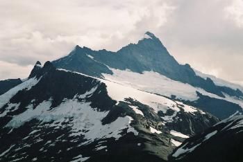
And here's a closer view of the mountain:
But I didn't have much time to admire the view. I had been very slow on the way up and since the clocks went back it was going to get dark quite early. So I set off down promptly. Rather than retrace my steps I had decided to take a more direct route, but this turned out to be a bad idea: I spent a lot of effort slipping and sliding down through the unpleasantly dense and sometimes spikey vegetation. It actually got dark as I was getting back to the bottom of the Rainbow Stream valley and I was very pleased with myself for having taken a GPS fix on the place where I had crossed the Kitchener River; if I hadn't I would never have found it and might have had to wade through waist-deep glacial-cold water! So I got back to my tent after eleven hours, thoroughly tired.
After all that the walk back the next day was a piece of cake. I got a bus back to Wanaka and then another all the way to Christchurch the same afternoon. And the next day flew to Melbourne.