| Previous: Part 1 : Misadventure in the Valée de Lutour | Index | Next: Part 3 : A Day Off in the Ordesa Canyon |
|
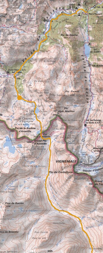
We spent a couple of nights in Cauterets as our things dried out; on the second morning we woke up to the sunshine that we'd been waiting for - plus a dusting of snow on the surrounding mountainsides! We were a bit worried in case this was going to make the passes ahead more difficult, but we set off anyway. This time we set off up a different valley, the Vallée du Marcadau, and to get a head start we took a taxi as far as the end of the road at Pont d'Espagne.
 |
The Vallée du Marcadau above Pont d'Espagne. |
|---|
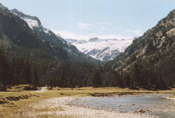
The Vallée du Marcadau is beautiful. A river flows through green meadows and groves of pine trees, and we were lucky enough to see it with blue skies and sprinklings of snow higher up. We walked for 6km or so up the path that was once an important trade route into Spain; at this point, near the Refuge Wallon, the view opens up and the frontier peaks Grande Fache and Pic Falisse come into view.
 |
Grande Fache and Pic Falisse. |
|---|
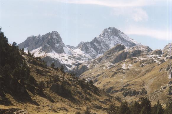
At this point we turned left into the even quieter Vallée d'Arratille and kept climbing until we found ourselves a pleasant camp site for the night.
 |
View from our camp in the Vallée d'Arratille. |
|---|
Total for the day:8km, 600m.
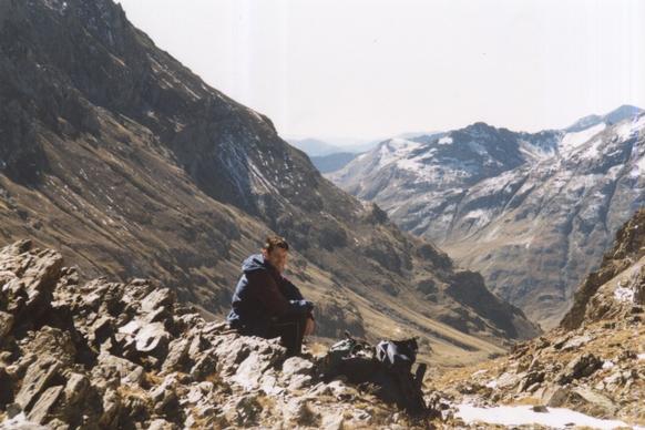
Next morning we set off early to climb to the col before it got too warm. As we climbed into a high cirque the mountains unfolded before us: what we initially thought were the frontier peaks turned out to be 400m too low! We came across a few small patches of snow high up, but not enough to cause any trouble.
 |
Katherine views the Grande Pic d'Arratille. |
|---|
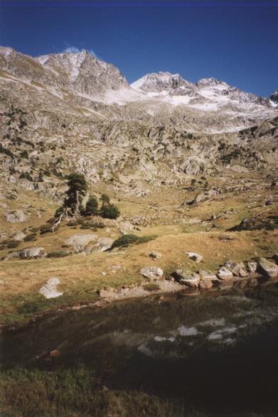
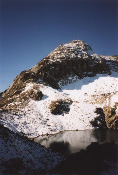 |
Le Lac du Col d'Arratille and Le Grande Pic d'Arratille. |
|---|
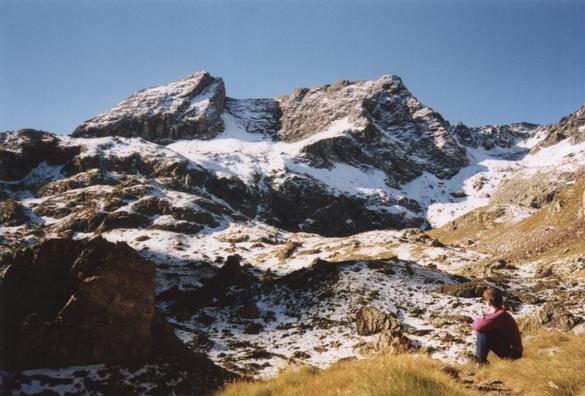
Just before the col there's a dark looking lake which was not appealing from the swimming point of view! Anyway we eventually got to the col, at 2528m, and looked into Spain for the first time. We spent a short time trying to scramble onto an adjacent peak, but it turned out to be much to steep.
 |
Phil and the view into Spain from the Col d'Arratille. |
|---|
The terrain on the Spanish side is distinctly different from that on the French side. Whereas France had pine trees, green meadows, babbling streams and the odd patch of snow, the Spanish ground was sun-dried and from here we could see no trees.
 |
Pico de Baciás. |
|---|
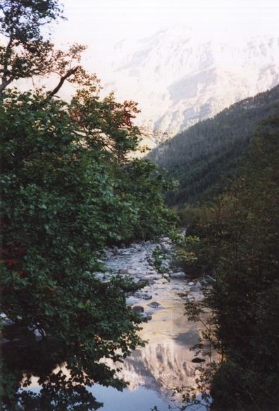
We spent the afternoon descending into Spain down the valley of the Río Ara. In due course some cattle and a few old farm buildings were spotted, and trees slowly took over the valley - but quite different types from what we'd seen in France.
 |
The Río Ara. |
|---|
 |
Mountains reflected in the Río Ara. |
|---|
Eventually as afternoon turned into evening we found ourselves a discrete spot for our tent near the river and relaxed after what had been our longest day so far.
Total for the day:15km, 450m.
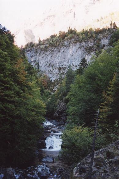
We spent the next day descending the Río Ara valley out of the mountains and almost to civilisation. The valley is steep-sided and wooded, and for much of the time the river is inaccessible in a deep gorge (though we did scramble down at one point for a quick swim!). There's an unmade road down one side and a footpath on the other.
 |
The Estrecho dera Escala. |
|---|
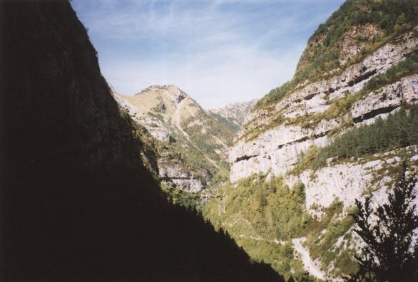
There was one especially dramatic section where the path was carved out of the cliff face.
 |
A narrow section on the Estrecho Dera Escala. |
|---|
At the end of the narrow section the valley opens out where the Río Arazas joins from the east. The Río Arazas flows through the Ordesa Canyon and at this point we got our first view of this famous national park: it looked good!
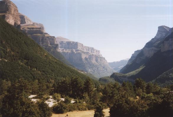 |
The Ordesa Canyon from A Liana. |
|---|
The path meets the road not far from the national park entrance; we walked towards the town of Torla until we got to the first campsite at San Antón.
Total for the day:8.5km, 200m.
| Previous: Part 1 : Misadventure in the Valée de Lutour | Index | Next: Part 3 : A Day Off in the Ordesa Canyon |