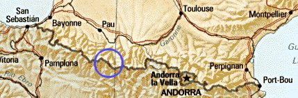
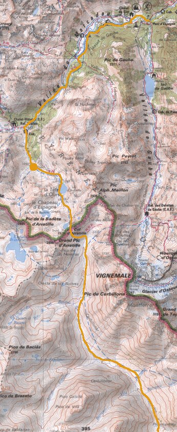
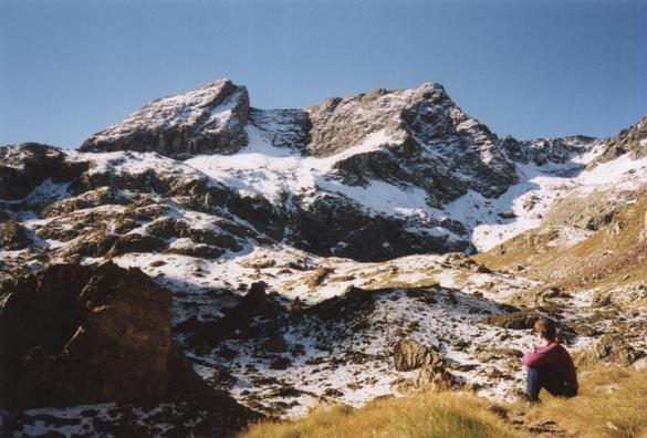
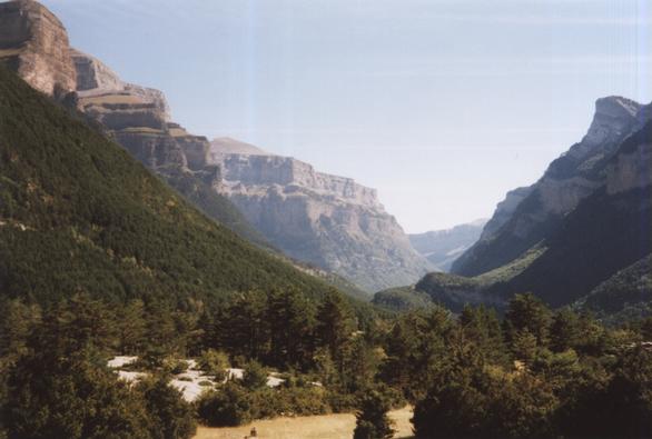
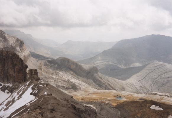
Our destination in the western-central Pyrenees.
|
Our destination in the western-central Pyrenees. |
|---|
Katherine and I spent a couple of weeks in the Pyrenees at the start of September 2000. My only previous visit had been brief - I cycled across the Col du Somport back in 1989 - but I'd had a book, "Long Distance Walks in the Pyrenees", on my shelf tempting me to go back.
This was our first, and as it turned out only, light-weight backpacking trip together. We took my small one-and-a-half person tent and only vague plans about what we would do. In the end we spent nine days walking, crossed the frontier once in each direction, and covered around a hundred kilometers.
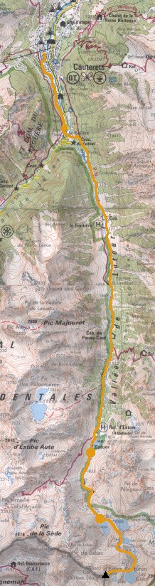 |
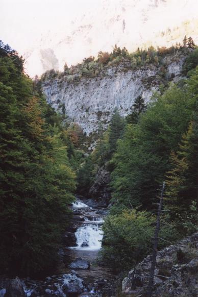
Our first day in the mountains! We arrived in Cauterets, a small town and in winter a ski resort, by bus in the middle of the day. Our plan was to walk as far up the Vallée de Lutour as we could that afternoon.
We didn't get off to a very auspicious start; the path we hoped to take had been blocked by a rockfall and we ended up walking up a road instead. But eventually we got up into the hills.
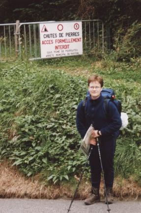 |
"Rockfalls! Access strictly forbidden." |
|---|
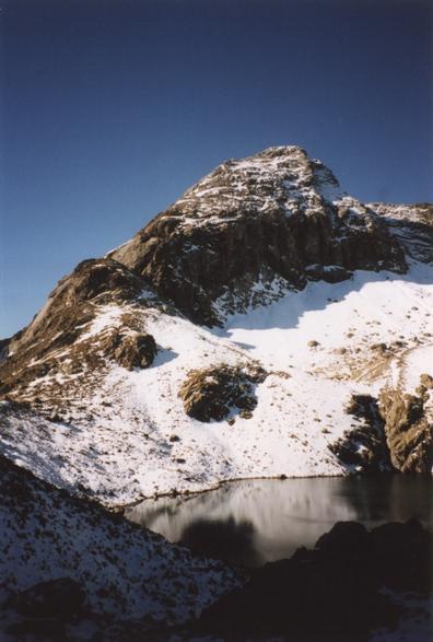
We ascended on a good path, steeply at first past the Cascade de Lutour and then more gently in the hanging valley. We spurned the intrusion of the hôtel on the other bank at La Fruitière and kept going until Lac d'Estom, a picturesque tear-drop-shaped lake with a refuge on its shore.
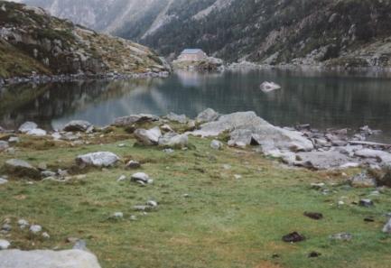 |
The Lac and Refuge d'Estom. |
|---|
Total for the day:12km, 900m.
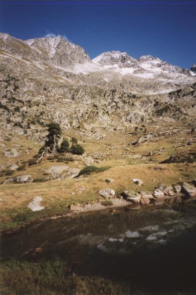
Our first night had been wet and windy, though not bad enough to put us off. In the morning the weather was sunny and we continued to gain more height, the terrain getting more and more rocky the further up we went. After a steep section we reached the first of a group of lakes, Lac de Labas. We decided to leave the camping things here and bag our first Pyrenean peak that afternoon.
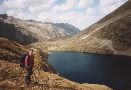 |
Katherine next to the second of the group of lakes, Lac des Oulettes d'Estom Soubiran. |
|---|
We left the path above the last of the lakes to find our way to the summit of Pic d'Estom Soubiran (2829m). The final bit of the ascent was rocky but not difficult.
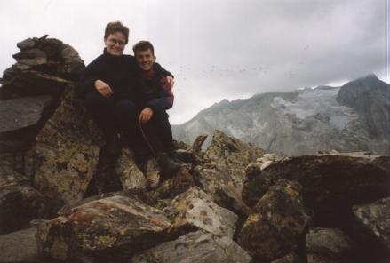 |
Timer photo on the summit of the Pic d'Estom Soubiran. |
|---|
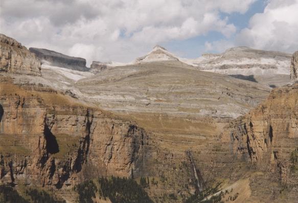
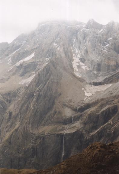
From the top we got some great views: to the north, back down the Vallée de Lutour; to the south east towards the Gavarnie peaks and the Brèche de Roland, and to the west the bulk of the Vignemale with its glacier.
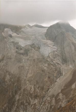 |
The Vignemale, with its head in the clouds, and the Glacier d'Ossoue. |
|---|
After taking in the views we descended as far as Lac de Labas for our standard evening meal of spaghetti and vegetable puree and then retired to the tent for what was to turn out to be a very eventful night...
Total for the day:7km, 1030m.
The weather had been getting cloudier all day so the overnight storm wasn't much of a suprise. Things weren't helped by our choice of camping site - it was rather exposed. Still the tent did hold up, despite loosing most of its pegs at one point, and we didn't get too wet. Anyway it was still raining quite heavily in the morning and we didn't feel up to our original plan of crossing into an adjacent valley, so we decided to return to Cauterets to dry out.
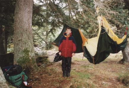 |
One Wet Tent. One Wet Hiker. |
|---|
Total for the day:14km, 0m.
 |
We spent a couple of nights in Cauterets as our things dried out; on the second morning we woke up to the sunshine that we'd been waiting for - plus a dusting of snow on the surrounding mountainsides! We were a bit worried in case this was going to make the passes ahead more difficult, but we set off anyway. This time we set off up a different valley, the Vallée du Marcadau, and to get a head start we took a taxi as far as the end of the road at Pont d'Espagne.
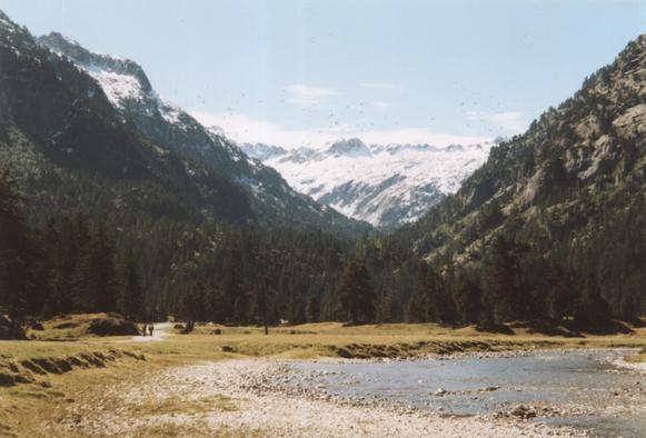 |
The Vallée du Marcadau above Pont d'Espagne. |
|---|
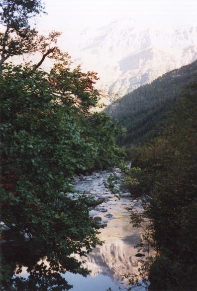
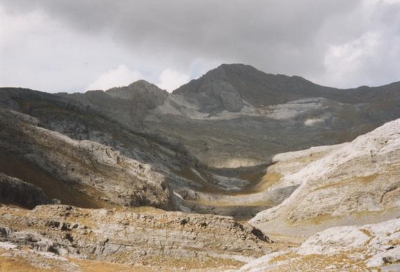
The Vallée du Marcadau is beautiful. A river flows through green meadows and groves of pine trees, and we were lucky enough to see it with blue skies and sprinklings of snow higher up. We walked for 6km or so up the path that was once an important trade route into Spain; at this point, near the Refuge Wallon, the view opens up and the frontier peaks Grande Fache and Pic Falisse come into view.
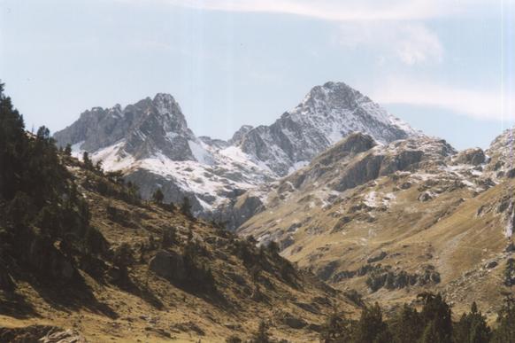 |
Grande Fache and Pic Falisse. |
|---|
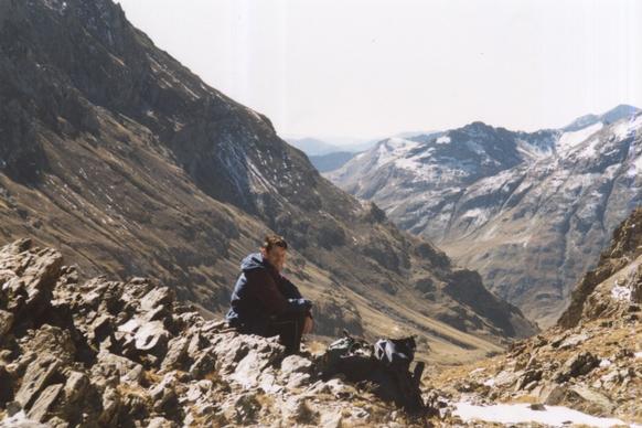
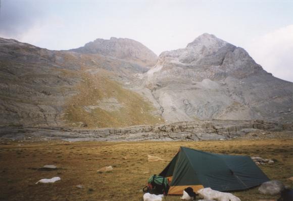
At this point we turned left into the even quieter Vallée d'Arratille and kept climbing until we found ourselves a pleasant camp site for the night.
 |
View from our camp in the Vallée d'Arratille. |
|---|
Total for the day:8km, 600m.
Next morning we set off early to climb to the col before it got too warm. As we climbed into a high cirque the mountains unfolded before us: what we initially thought were the frontier peaks turned out to be 400m too low! We came across a few small patches of snow high up, but not enough to cause any trouble.
 |
Katherine views the Grande Pic d'Arratille. |
|---|
 |
Le Lac du Col d'Arratille and Le Grande Pic d'Arratille. |
|---|
Just before the col there's a dark looking lake which was not appealing from the swimming point of view! Anyway we eventually got to the col, at 2528m, and looked into Spain for the first time. We spent a short time trying to scramble onto an adjacent peak, but it turned out to be much to steep.
 |
Phil and the view into Spain from the Col d'Arratille. |
|---|
The terrain on the Spanish side is distinctly different from that on the French side. Whereas France had pine trees, green meadows, babbling streams and the odd patch of snow, the Spanish ground was sun-dried and from here we could see no trees.
 |
Pico de Baciás. |
|---|
We spent the afternoon descending into Spain down the valley of the Río Ara. In due course some cattle and a few old farm buildings were spotted, and trees slowly took over the valley - but quite different types from what we'd seen in France.
 |
The Río Ara. |
|---|
 |
Mountains reflected in the Río Ara. |
|---|
Eventually as afternoon turned into evening we found ourselves a discrete spot for our tent near the river and relaxed after what had been our longest day so far.
Total for the day:15km, 450m.
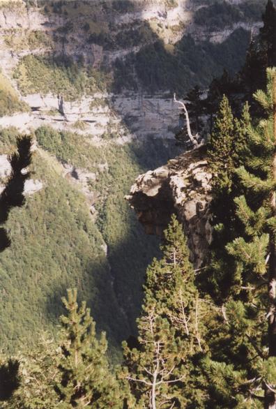
We spent the next day descending the Río Ara valley out of the mountains and almost to civilisation. The valley is steep-sided and wooded, and for much of the time the river is inaccessible in a deep gorge (though we did scramble down at one point for a quick swim!). There's an unmade road down one side and a footpath on the other.
 |
The Estrecho dera Escala. |
|---|
There was one especially dramatic section where the path was carved out of the cliff face.
 |
A narrow section on the Estrecho Dera Escala. |
|---|
At the end of the narrow section the valley opens out where the Río Arazas joins from the east. The Río Arazas flows through the Ordesa Canyon and at this point we got our first view of this famous national park: it looked good!
 |
The Ordesa Canyon from A Liana. |
|---|
The path meets the road not far from the national park entrance; we walked towards the town of Torla until we got to the first campsite at San Antón.
Total for the day:8.5km, 200m.
 |
So far we'd carried our full rucksacks every day and it seemed like time for a day off, so we decided to spend a day doing a light-weight tour of the Ordesa Canyon. It turned out to be an excellent walk.
There's a bus into the Ordesa Canyon from Torla, where there is a large car park, and during the summer other vehicles are not allowed in, so the park is pleasantly traffic free. Unfortunately the bus doesn't stop anywhere between Torla and the national park - aarghh! - so we had to start by walking 2km back to Torla from our camp site at San Antón.
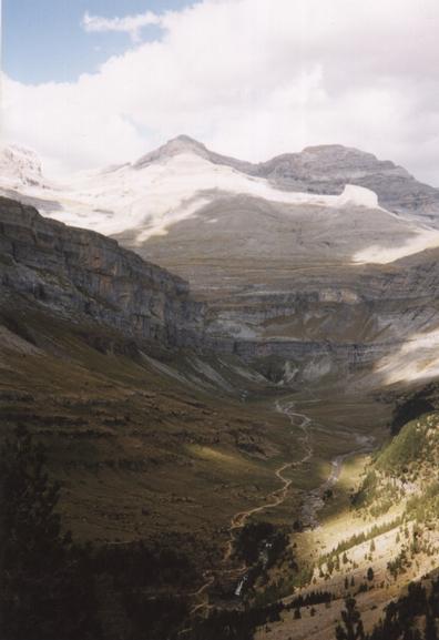
We decided to walk the length of the valley high up on the south side, returning down the middle. So the walk started with a long, steep climb through the trees, with occasional and increasingly impressive views when there were gaps in the canopy. Eventually we were high enough to see over the north rim of the canyon to the peaks beyond - including the Brèche de Roland.
 |
The Brèche de Roland and the Casque du Marboré above the Circo de Cotatuero. |
|---|
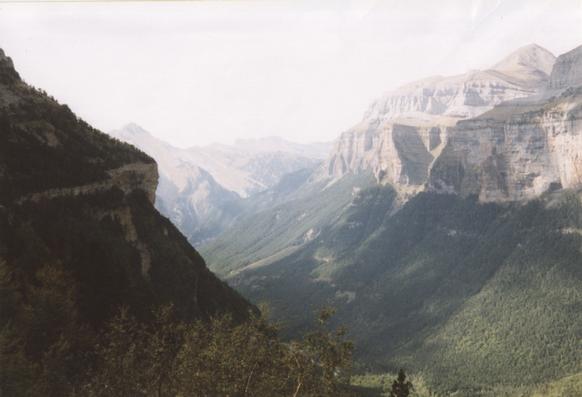
We did practically all of the day's climbing in that initial ascent. From there on the path contoured along; at times it was narrow and often there were enormous drop below. Slowly the upper reaches of the canyon and the peaks beyond were revealed, along with equally good views behind us.
 |
The steep south side of the Ordesa Canyon. |
|---|
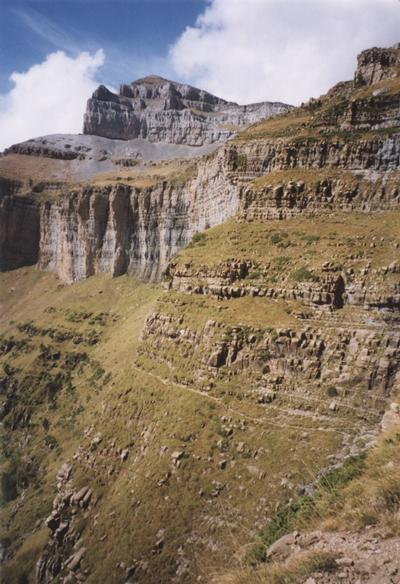
 |
The upper canyon revealed, with Monte Perdido in the background. |
|---|
 |
Looking back down the canyon. |
|---|
As our path contoured along the valley floor slowly climbed to meet us. Once we reached it in the Circo de Soaso we still had a long walk back to do! There were many more people on the path down the middle of the valley; it mostly descended among the trees with a few diversions to look at waterfalls.
By the time we finally got back to the camp site our "rest day" had been the longest day of the trip - and certainly well worth it.
Total for the day:19.5km, 650m.
 |
Now it was time to head back towards the frontier. We had decided to cross back into France at the Brèche de Roland, a landmark that we had seen in the distance from a couple of vantage-points during the preceding days. We would do this in two days, camping as high up as we could get on the Spanish side.
So on this morning we started by returning to the Ordesa Canyon. We decided to walk into the canyon rather than take the inconvenient bus, but with hindsight walking can't be recommended. The map shows paths from near the park entrace up to the visitor center in the old parador and from there through the forest parallel to the road; these paths are both closed and there is no alternative to walking along the tarmac.
Anyway, we eventually started climbing up the North side of the canyon. The path was steep but not too hot thanks to the shade of the trees. It was much like our ascent on the other side the day before, except that this time we were carrying our full racksacks. Eventually we emerged out of the trees; the path continued to ascend, but there seemed to be sheer cliffs above us and it was hard to believe that there was a route through. The path was narrow with occasional cables to hold on to and some scrambling, and always a huge drop beneath.
 |
Cliffs at the top of the climb, and el Tozal Del Mallo |
|---|
Eventually we made it to the top and the very different landscape of the plateau was revealed. So many people see the Ordesa Canyon, but so few see this. We followed a dry valley; in places the terrain was bare limestone and elsewhere there were patches of grass. We saw a few small streams but they disappeared quickly into caves.
 |
The dry valley, with Cabierto Norte on the skyline |
|---|
Finally we reached the end of the dry valley at what looked like a dried-up lake bed, and we found a corner for our tent for the night. It wasn't our longest walk by a long way, but it certainly had the most ascent.
 |
Camping at the Plana Caturate with Punta Blanca and part of Le Taillon in the background |
|---|
Total for the day:9km, 1350m.
The next morning we packed up and headed up hill, aiming for a gap at 2836m between Punta Blanca and the frontier ridge.
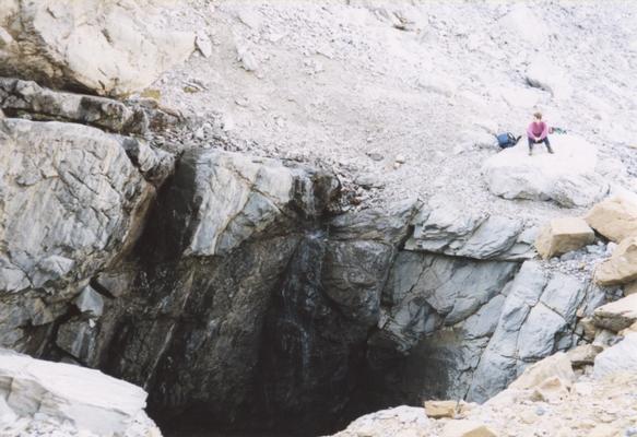 |
A huge cave on the way to Punta Blanca |
|---|
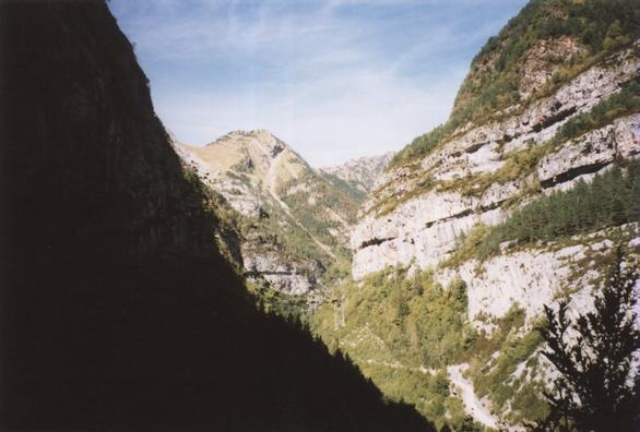
From the gap it looked as if the rocky slopes ahead finished at the foot of an inpenetrable cliff, but we knew that somewhere in there was the Brèche de Roland, and as we got closer it slowly revealed itself.
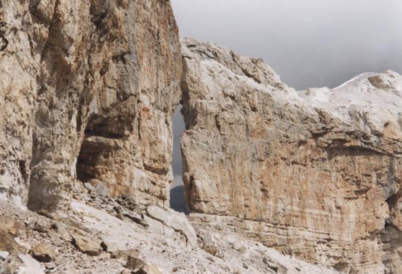 |
The Brèche de Roland as it reveals itself |
|---|
We eventually reached the frontier, to be met by dozens of other visitors - the first people we'd seen since we climbed out of the Ordesa Canyon. From here we took a 2km diversion to bag the summit of Le Taillon, our first and only 3000m peak at 3144m.
 |
View South-Eastwards from near Le Taillon |
|---|
There was no view westwards from Le Taillon - in fact as storm was coming in from that direction, so we wasted no time starting our descent. We returned to the Brèche de Roland and descended to the refuge, crossing a minute glacier on the way. From here we decided to take the steep "Echelle des Saradets" path down to the Cirque de Gavarnie. The view of the Cirque is indeed impressive, with one large waterfall and several smaller ones tumbling into it.
 |
La Grande Cascade |
|---|
At about this point the storm caught up with us and followed us down to the village of Gavarnie, where we ended our trip dripping in a restraunt.
Total for the day:13.5km, 730m.
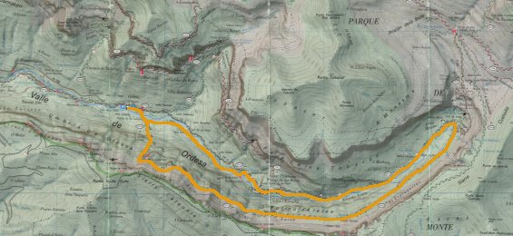
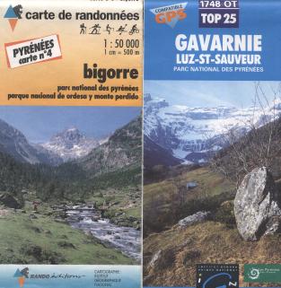
We had a variety of maps. There is a series of French 1:50,000 IGN maps overprinted with hiking routes by "Rando Éditions" that covers the Pyrenees in 11 sheets; we used sheets 3 and 4. These have reasonable cartogrpahy and go a short distance into Spain, though with decreased detail. Like quite a few French maps they have no grid lines, which makes compass bearings, let alone GPS readings, rather difficult.
There are also 1:25,000 IGN sheets, which are similar with increased detail. These ones do have grid lines - in fact they have two sets, one GPS compatible UTM grid in blue and a "legacy" grid in black. We had sheet 1748OT, "Gavarnie / Luz-St-Sauveur".
 |
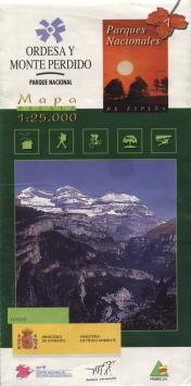
On the Spanish side we used a 1:25,000 map entitled "Ordesa Y Monte Perdido" and "Parques Nationales 7". It claims to be published ("editan") by the Ministerio de Fomento / Ministerio de Medio Ambiente (approx. Ministry of the Environment), though the national park officials denied this. The base map cartography is good, though the overprinted hiking information is rather unpleasant. There are two major deficiencies however: first, we found that some of the paths don't exist any more on the ground. Second, although the grid looks like a GPS-compatible UTM grid, it isn't. UTM divides the world into zones, and a zone boundary crosses this map. But rather than show this correctly, the grid for the larger right-hand zone has simply been extrapolated into the left-hand zone. This makes a big chunk of the map useless for GPS.
 |
We took one guidebook with us, the Cicerone Guide "Walks & Climbs in The Pyrenees" by Kev Reynolds (ISBN 1-85284-133-8). This is a useful book that is sufficient to give a good feeling for the area. I also have a book "Long Distance Walks in the Pyrenees" by Chris Townsend (ISBN 1-85223-391-5), which includes some nice photos and the sort of overview that can help when deciding where to go.
We took the train - Eurostar from London to Paris, then the sleeper to Lourdes. This gave us an afternoon to enjoy in Paris and got us closer to the mountains than any plane would, and got us there early enough to get the SNCF bus to Cauterets. The train is also, of course, much more environmentally friendly than flying.
Although there is a good bus service to Cauterets for the start of the walk, getting back from Gavarnie was more difficult! It seems that there is a bus during the summer and also during school term, but we hit the couple of weeks between the tourists leaving and the schools starting! We ended up walking to Luz-St-Sauveur over two days from where there is a good bus service.